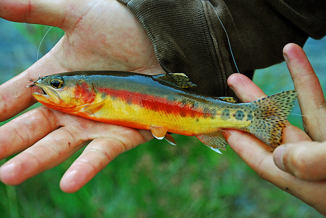
Photo: David Bakken · CC BY-SA 2.0 · Wikimedia Commons
Heads up: Weekends near the water fill first. Book the campsite before the gear.



Quick facts
- Type
- River
- State
- California
- Length
- About 13.7 miles
- Boat ramps
- None listed
- Campgrounds
- 1
- Fish species
- None recorded
Get on the water
Ramps & rentals
Bring the boat on wheels
Rent a campervan and paddle from shore, or gear up for a day at the water.
Affiliate linksWhere to stay
Camp near the water
Private sites nearby
Ranch, desert and waterfront sites hosted by landowners.
Affiliate linkCabins and hotels near Golden Trout Creek
Lake houses, cabins and hotels close to the water, with free cancellation on many stays.
Affiliate linkOff the water
Nearby trails
Trailheads from OpenStreetMap and hand-checked notes. Open the trailhead in your hiking app for full route details.
Before you launch
Gas, bait & supplies nearby
Bait and tackle
- Big Willi Mountaineering Company 120 South Main Street, Lone Pine16.8 miDirections
- Triple Crown Outfitters 98953 Sacatar Ranch Road, Inyokern · Mo-Su 09:00-15:0027.6 miCallDirections
RV dump and fresh water
- RV dump stationDump station12.6 miDirections
Ranger stations
- Kern Canyon Ranger Station0.6 miDirections
- Rock Creek Ranger Station5.5 miDirections
- Trout Meadows Forest Service Station10.2 miDirections
- Crabtree Ranger Station10.3 miDirections
Hospitals and urgent care
- Southern Inyo HospitalEmergency 501 East Locust Street, Lone Pine · 24/717.2 miCallDirections
- Family Healthcare Network28.5 miDirections
- Tule River Indian Health Center31.2 miDirections
Distances are straight-line from the water. Listings © OpenStreetMap contributors; hours change, so call ahead. In an emergency, call 911.
Trip planner
Build your weekend
Packing list
Don't forget
Good to know
Golden Trout Creek FAQ
Where can I camp near Golden Trout Creek?
Campgrounds near the water include Irene’s Camp. When public sites are full, private sites nearby are listed on Hipcamp.
Where can I buy bait near Golden Trout Creek?
Bait and tackle nearby: Big Willi Mountaineering Company (16.8 mi), Triple Crown Outfitters (27.6 mi). Hours change, so call ahead.
Keep exploring
Nearby water
Sources: USGS 3DHP and National Atlas (rivers via Esri Living Atlas), Recreation.gov RIDB, OpenStreetMap contributors, CDFW and AZGFD, GBIF, NWS. Photo credits are listed on the photo credits page. All outbound links are affiliate links.